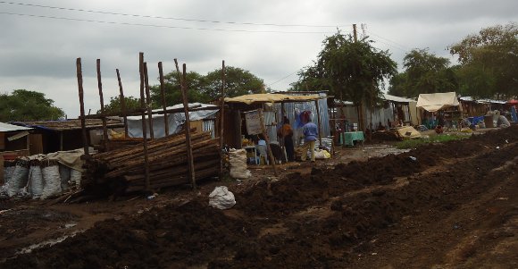
 The customs point in Elegu, Uganda, is at the centre of a local land dispute that has become international
In September 2012, the Refugee Law Project (RLP) conducted a conflict context analysis of the land dispute in Elegu. The detailed report about the land dispute can be accessed from RLP website under the ACCS activity updates. The land conflict in Elegu previously played out between two Madi clans, namely the Oyapele and the Ofodro; they are historically separated by the South Sudanese/Ugandan border instituted in the wake of British colonialism. The Oyapele live on the Southern Sudanese side in the village of Matoyo, and the Ofodro on the Ugandan side, in Elegu. Historically, the Oyapele and Ofodro shared strong cross-border ties, maintaining a mutually cooperative relationship in times of hardship.
During the Second Sudanese Civil War, the Oyapele in Uganda were registered as refugees by the Government of Uganda, and sent to refugee camps in Adjumani and Moyo districts. However, after the Comprehensive Peace Accord (CPA) in Sudan in 2005, the Oyapele lost their refugee status and returned to Sudan, yet some remained doing business in Uganda. At the same time, the Ofodro were displaced to IDP camps due to the Lords Resistance Army insurgency, leaving their original land in Elegu lying idle.
The key finding of the RLP research indicated that vested economic interest was key conflict trigger in the Elegu. In 2007 the Government of Uganda decided to build a customs point in Bibia – Amuru district, which triggered conflict over land ownership between the local Mukolo and Alur clans. In effort to quell the dispute, the central government obtained land in Elegu and officially inaugurated the Elegu custom point in March 2012. While the area was previously free of land dispute, the economic importance and the strategic relocation of the custom point have resulted into tension in Elegu.
The dispute over land in Elegu centers on a stretch of 4 km² area along the border of Uganda and South Sudan. No dispute and claims of ownership have been made outside the, so-called, “hot cake” stretch. But this has of late changed with the Government of South Sudan accusing Uganda of putting development infrastructure beyond Uganda international boundary, calling it an act of trespass.
As stated by an immigration official at Elegu customs point, “it is difficult to say whether the Oyapele are Ugandans or whether they are Sudanese, because of the history of co-settlement with the Ofodro and the countless cross-border movements”. The cross-border movements between the Oyapele and Ofodro has resulted in intermarriages; further complicating questions of citizenship and claims to land ownership.
At the same time, the Amuru district leadership does not recognize any of the ownership claims made by the Ofodro over the disputed land, but called for the intervention of the central Government in Uganda to respond to the accusation being made by their South Sudan counterparts. Various conflict mitigation strategies were recommended, including 3rd party mediation. It was demanded that the Government of Uganda strengthen the functionality of immigration office at Elegu border entry point.
Both Amuru and Adjumani district local government advocated for quick and transparent access to archive information regarding the 1962 British colonial border demarcations and historical accounts of local tax payment to sort out the issue of administrative boundaries between Adjumani and Amuru. Whereas civil society organisation representatives in the area held that the best way to handle the Elegu conflict is through respected community leaders of the conflict parties involved, as they know local history and culture, the land dispute in Elegu continues to transgress and largely remain unresolved.


